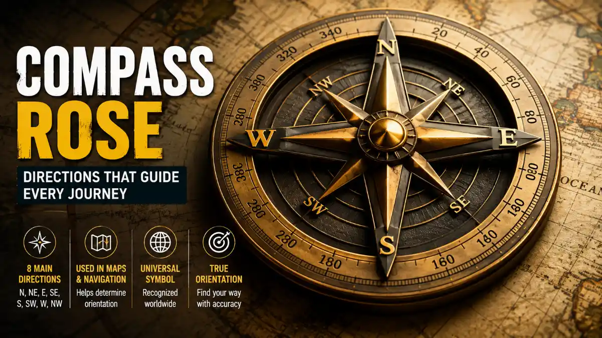

A compass rose is a symbol printed on maps, charts, and compasses that displays the cardinal and intermediate directions, helping readers understand a map’s orientation and navigate using it. It typically shows north, south, east, and west, along with additional points such as northeast and southwest for more precise direction-finding.
Almost every direction, distance, and location reference on a map depends on correctly reading this symbol first. This guide walks through the cardinal and intermediate directions, how bearings work, the different types of compass rose symbols, and how to apply them to real map-reading situations.
Compass Points and Bearings
| Direction | Abbreviation | Bearing | Opposite Direction |
| North | N | 0°/360° | South |
| Northeast | NE | 45° | Southwest |
| East | E | 90° | West |
| Southeast | SE | 135° | Northwest |
| South | S | 180° | North |
| Southwest | SW | 225° | Northeast |
| West | W | 270° | East |
| Northwest | NW | 315° | Southeast |
Read More: Compass Rose
What Does a Compass Rose Show?
A compass rose shows the directional orientation of a map by displaying the four cardinal directions and, in more detailed versions, the intermediate directions between them. Cartographers include it because a map can be printed at any angle, and without a fixed reference point, there’s no reliable way to know which direction is “up” on the page.
8-point compass rose: cardinal directions appear every 90°, while intermediate directions fall halfway between them at 45° intervals.
Most modern maps orient north toward the top, but this is a convention rather than a fixed rule. Some historical maps, trail maps, and specialty charts orient differently, which is exactly why checking the compass rose first – rather than assuming north sits at the top – matters for accurate map reading.
The Four Cardinal Directions
The cardinal directions are the four primary points on a compass rose – North (N), East (E), South (S), and West (W) – spaced exactly 90 degrees apart.
| Direction | Abbreviation | Bearing |
| North | N | 0°/360° |
| East | E | 90° |
| South | S | 180° |
| West | W | 270° |
A common classroom mnemonic, “Never Eat Soggy Waffles,” lists the cardinal directions in the clockwise order used in cartography. Compass bearings are conventionally measured clockwise from north, which is why the sequence N → E → S → W matches the direction bearings increase around the circle.
Intermediate Directions Explained
Intermediate directions, also called intercardinal or ordinal directions, are the four points located exactly halfway between each pair of cardinal directions: Northeast (NE), Southeast (SE), Southwest (SW), and Northwest (NW). These exist because real-world locations rarely align with a single cardinal direction – a location between north and east is described far more precisely as “northeast” than by either cardinal direction alone.
Together with the four cardinal points, these eight directions form the 8-point compass rose, a version widely used in introductory geography education and on everyday maps.
How Bearings Work on a Compass Rose
A bearing is a direction expressed in degrees, measured clockwise from north, running from 0° at north through 360° back to north. This numeric system lets navigators describe direction precisely instead of relying only on named points.
- 0° = North
- 90° = East
- 180° = South
- 270° = West
- 360° = back to North
A bearing of 135°, for instance, falls exactly at southeast. This degree-based structure is what makes 16-point and 32-point compass rose designs possible – each additional point simply divides the 360-degree circle into smaller, evenly spaced segments.
How to Read a Compass Rose on a Map
To read a compass rose, locate north first, then use its position to work out every other direction relative to it.
- Locate north first. Look for the letter “N,” an arrow, a star, or a fleur-de-lis symbol.
- Check the map’s actual orientation. Confirm which way north points rather than assuming it’s at the top.
- Identify the remaining cardinal points. Moving clockwise from north gives east, then south, then west, each 90 degrees apart.
- Read intermediate directions if shown. Locate northeast, southeast, southwest, and northwest between the cardinal points.
- Use bearings for precision. If the rose includes a 360-degree scale, read the exact bearing (e.g., 135° for southeast) rather than estimating.
Practical Example
Suppose a park sits at the center of a map, a school is directly north of the park, and a library is directly east of the school. Tracing north from the park to the school, then east from the school to the library, places the library northeast of the park overall. Working through an example like this, using the compass rose as a fixed reference point, builds the skill faster than memorizing definitions alone.
Compass Rose vs. a Physical Compass
A compass rose and a physical compass are related but distinct tools: one is a printed reference, the other is a working instrument.
| Feature | Compass Rose | Physical Compass |
| Form | Printed symbol on a map or chart | Physical handheld instrument |
| Function | Shows the map’s directional orientation | Points toward magnetic north in real time |
| Movement | Static – fixed to the map | Needle moves as you turn |
| Typical use | Reading and interpreting maps | Real-world navigation and orienteering |
Read More: Compass Rose
Navigators typically use both together, aligning a compass needle with the map’s north indicator to estimate a real-world bearing. When precision matters – such as backcountry hiking or marine navigation over distance – navigators also account for magnetic declination, the offset between magnetic north and true north, when converting between map bearings and compass readings.
Types of Compass Rose Symbols: 16-Point and 32-Point Roses
Beyond the basic 8 points, more detailed compass rose symbols subdivide the circle further for navigation contexts that benefit from finer precision, such as sailing, aviation, and historical charting.
16-Point Compass Rose
A 16-point rose adds eight secondary intermediate directions, formed by bisecting the angle between each cardinal and intermediate point: North-Northeast (NNE), East-Northeast (ENE), East-Southeast (ESE), South-Southeast (SSE), South-Southwest (SSW), West-Southwest (WSW), West-Northwest (WNW), and North-Northwest (NNW). Each point sits 22.5 degrees from its neighbors.
16-point compass rose: secondary intermediate directions divide the circle into 22.5° segments for finer precision.
32-Point Compass Rose
The 32-point rose divides the circle into segments of 11.25 degrees each, using historical naming conventions such as “north by east.” The compass rose has long served as a core plotting feature on nautical charts, allowing mariners to determine course and bearing directly from the chart. Many nautical charts still include a graduated compass rose today, both as a functional plotting tool and as a link to that navigational tradition.
Comparison of Compass Rose Types
| Type | Number of Points | Degrees Between Points | Common Context |
| 4-point | 4 (cardinal only) | 90° | Basic maps, early geography education |
| 8-point | 8 (cardinal + intermediate) | 45° | Everyday maps, introductory geography |
| 16-point | 16 | 22.5° | More detailed maps requiring finer direction |
| 32-point | 32 | 11.25° | Nautical charts, historical navigation |
True North, Magnetic North, and Grid North
True north points toward the geographic North Pole, while magnetic north is the direction a compass needle actually follows, a direction that shifts gradually over time as Earth’s magnetic field changes. Charts and topographic maps sometimes display a third reference as well.
- True north: the fixed direction toward the geographic North Pole, following the Earth’s lines of longitude.
- Magnetic north: the direction a compass needle points, which drifts over time and differs by location.
- Grid north: the direction of the vertical grid lines on a map’s coordinate system, such as UTM. Grid north, true north, and magnetic north can each differ slightly depending on location and the map’s projection, an offset called grid convergence.
On charts showing true and magnetic north together, two concentric circles are common: the outer ring marks true north, fixed to the geographic pole, while the inner ring marks magnetic north. The angular gap between them is called magnetic declination, and its size varies by location on Earth. This distinction matters most for sailors, pilots, and hikers navigating with a physical compass and chart, since applying the wrong reference over long distances can cause a meaningful course error.
Why Compass Roses Still Matter
Even with GPS and digital navigation apps handling most everyday direction-finding, compass roses remain a foundational teaching tool in geography education and continue to appear on nautical charts, historical maps, and orienteering materials. Many digital mapping interfaces use a simplified orientation indicator – usually a small arrow or “N” marker – that serves the same basic function without the decorative design.
For students, mastering the compass rose builds the groundwork for related map skills, including reading latitude and longitude, understanding map scale, and interpreting topographic contour lines.
Frequently Asked Questions
What is the difference between cardinal and intermediate directions?
The cardinal directions (N, E, S, W) are 90 degrees apart and form the compass rose’s four main points. Intermediate directions (NE, SE, SW, NW) fall exactly between them, at 45 degrees from each neighboring cardinal point, allowing for more precise direction descriptions on maps.
How many points does a compass rose have?
Compass roses commonly come in 4-point, 8-point, 16-point, and 32-point versions, with each step dividing the circle into smaller, evenly spaced segments: 90°, 45°, 22.5°, and 11.25°, respectively. The 8-point version is the one most learners encounter first.
Why is north often marked with a special symbol?
North is often emphasized with a star, arrow, or decorative fleur-de-lis so readers can identify it quickly. This visual emphasis remains common in educational and decorative compass rose designs, even though it isn’t functionally required for the symbol to work.
Does north always point to the top of a map?
Not always. Most modern maps place north at the top by convention, but this isn’t universal – some historical maps, trail maps, and specialty charts orient differently. Checking the compass rose or north arrow directly, rather than assuming orientation, avoids navigation errors on unconventional maps.
What is magnetic declination and why does it matter?
Magnetic declination is the angular difference between true north and magnetic north, and it varies by location and shifts gradually over time. It matters most for anyone navigating with a physical compass and a paper map, since ignoring declination can cause a meaningful directional error over longer distances.
What is grid north, and how is it different from true and magnetic north?
Grid north is the direction of the vertical grid lines on a map’s coordinate system, such as UTM, rather than the geographic pole or a compass needle. Because flat maps distort the curved Earth, grid north can differ slightly from true north – an offset known as grid convergence – and both can differ from magnetic north. On most everyday maps, this difference is small enough to ignore, but it becomes relevant in precise land navigation and surveying.
How do you draw a simple compass rose?
Start with a vertical and horizontal line crossing at a center point to mark north, south, east, and west, labeling north at the top and moving clockwise for the rest. For an 8-point version, add a smaller X shape rotated 45 degrees between the main lines to mark northeast, southeast, southwest, and northwest.
Are compass roses still used on digital maps and GPS apps?
Digital maps and GPS apps rarely include a full decorative compass rose, but most display a simplified directional indicator – usually a small arrow or “N” marker – serving the same core function. Full 16-point or 32-point roses are now mostly reserved for printed nautical charts, historical maps, and educational materials.
What’s a quick way to practice reading a compass rose?
Try a simple exercise: if a school is north of a park, and a library is east of the school, the library sits northeast of the park overall. Practicing a few examples like this on an actual map – tracing directions between two or three landmarks – builds the skill faster than memorizing definitions alone.
Why do nautical charts sometimes show two compass rings instead of one?
Charts with two concentric circles are typically distinguishing true north from magnetic north. The outer ring shows true north, fixed relative to the geographic pole, while the inner ring shows magnetic north, which shifts over time and location. This dual-ring design helps navigators convert accurately between map bearings and compass readings.