Category: Travel

  • 720 Area Code: Location, Cities, Time Zone & Phone Number Guide

    720 Area Code: Location, Cities, Time Zone & Phone Number Guide

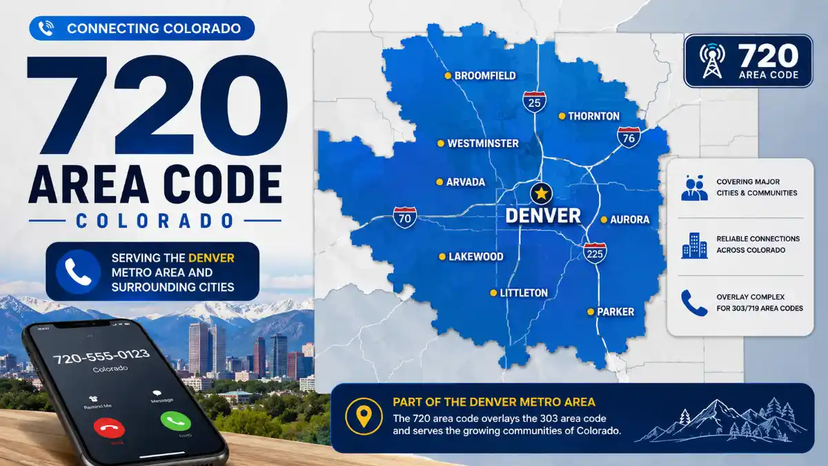
    The 720 area code is a Colorado telephone area code serving the Denver-Boulder region and surrounding communities in north-central Colorado. It is part of the 303/720/983 overlay complex, so 720 does not represent a separate geographic zone from 303 or 983. All three area codes can be assigned within the same general service area.

    If you received a call or text from a 720 phone number, the number is associated with the Denver-area numbering region. However, the area code alone cannot tell you exactly which city the caller is in, which carrier they use, or whether the caller is physically located in Colorado at the time of the call.

    Here is what you need to know about the 720 area code, including its location, cities, relationship with 303 and 983, time zone, dialing rules, history, and what a 720 number means today.

    Where Is the 720 Area Code Located?

    The 720 area code is located in Colorado, primarily serving the greater Denver-Boulder metropolitan region and nearby Front Range communities. Denver is the largest and most prominent city associated with the numbering area, but the code is not limited to Denver itself.

    The important point is that 720 is an overlay area code. Instead of dividing Colorado into a separate 720 geographic zone, it shares the same general numbering-plan area as 303 and 983. The North American Numbering Plan Administrator (NANPA) currently identifies Colorado’s 303/720/983 combination as an overlay complex with 10-digit local dialing.

    This means two people living in the same neighborhood could have different area codes. One person might have a 303 number, another a 720 number, and another a 983 number.

    What State Is Area Code 720 In?

    Area code 720 is in Colorado, United States.

    It is associated most strongly with the Denver metropolitan area and nearby communities along Colorado’s Front Range. The area code does not indicate that a caller is specifically inside Denver city limits.

    Which Cities Use the 720 Area Code?

    The 720 area code is used across a broad group of cities and communities in the Denver-Boulder region. Major communities associated with the 303/720/983 overlay include:

    • Denver
    • Aurora
    • Boulder
    • Lakewood
    • Thornton
    • Arvada
    • Westminster
    • Centennial
    • Longmont
    • Littleton
    • Englewood
    • Broomfield
    • Castle Rock
    • Brighton
    • Commerce City
    • Highlands Ranch
    • Parker
    • Northglenn
    • Lafayette
    • Golden

    The exact availability of a particular area code can vary by exchange and numbering assignment, so a city’s association with the overlay does not mean every telephone number in that city begins with 720. Current city listings show multiple area codes across the same communities.

    Does 720 Mean the Caller Is in Denver?

    No. A 720 phone number does not necessarily mean the caller lives in Denver.

    Denver is the primary city associated with the area code, but 720 numbers are also used throughout the broader numbering region. Someone with a 720 number could live or operate a business in another community such as Aurora, Boulder, Lakewood, Thornton, or one of the surrounding areas.

    There is another important limitation: mobile and VoIP users can keep numbers after moving, so the area code does not reliably establish a person’s current physical location.

    720 Area Code Location at a Glance

    DetailInformation
    Area code720
    StateColorado
    Primary regionGreater Denver-Boulder area
    Major cityDenver
    Overlay complex303 / 720 / 983
    Time zoneMountain Time
    Local dialing10 digits
    In service since1998
    Numbering typeGeographic area code

    Read More: 720 Area Code

    NANPA’s current numbering information confirms that 720 belongs to the 303/720/983 overlay complex and uses a 10-digit local dialing plan.

    How Is 720 Connected to 303 and 983?

    The relationship between 303, 720, and 983 is one of the most important things to understand about this region.

    An overlay occurs when multiple area codes serve the same geographic area. Instead of assigning one code to one side of a city and another code to the other side, an overlay allows new telephone numbers to receive a different area code within the existing service region.

    Area code 720 was introduced as an overlay for 303 in 1998. NANPA’s planning records document the 1998 overlay of 303 with 720.

    The region later received another overlay code, 983. NANPA assigned 983 to overlay the existing 303/720 area, and the new code entered service on June 17, 2022.

    303 vs. 720 vs. 983

    Area CodeRole in the RegionIn Service
    303Original Denver-area code1947
    720Overlay for the 303 region1998
    983Additional overlay for the same region2022

    The three codes are therefore not three separate Denver-area zones. They form one overlay complex. A 720 number and a 303 number can belong to people living next door to each other.

    When Did the 720 Area Code Start?

    The 720 area code was introduced in 1998 to provide additional numbering capacity for the Denver-area region. Contemporary NANPA planning records document the overlay of 303 with 720 in March 1998, while area-code reference records identify June 1, 1998, as the 720 in-service date.

    The need for additional numbering capacity was connected to continued growth and demand for telephone numbers in the Denver region. Rather than splitting the existing territory into a new geographic area, 720 was implemented as an overlay.

    That approach allowed existing 303 customers to keep their telephone numbers while new numbers could be assigned from the additional area-code pool.

    As of 2026, the 720 area code has been in service for about 28 years.

    Why Does Denver Have Three Area Codes?

    Denver and its surrounding communities have three area codes because the region needed additional telephone-numbering capacity over time.

    The original 303 area code dates to the beginning of the North American Numbering Plan in 1947. As demand for numbers increased, 720 was introduced in 1998. The region later received 983, which became active in 2022.

    The important practical difference between an overlay and a traditional area-code split is that an overlay does not assign each code to a different physical section of the region.

    Instead, the codes coexist.

    That is why a Denver-area address can potentially have a 303, 720, or 983 telephone number.

    Do You Have to Dial 10 Digits With a 720 Number?

    Yes. Ten-digit dialing is used for local calls within the 303/720/983 overlay region. That means callers use the three-digit area code plus the seven-digit telephone number rather than relying on seven-digit local dialing. NANPA identifies the 303/720/983 complex as a 10-digit dialing area, and Colorado’s regulatory guidance confirms that customers in the overlay region use 10 digits for local calls.

    For example, a local number would be dialed in this general format:

    720-XXX-XXXX

    The same principle applies when calling a number with 303 or 983 from within the overlay region.

    Why Is 10-Digit Dialing Required?

    With multiple area codes serving the same geographic area, the telephone network cannot determine the intended destination from only the seven-digit local number.

    Requiring the area code removes that ambiguity.

    NANPA explains that 10-digit dialing is a regulatory requirement associated with overlay area codes and provides dialing parity among the codes serving the same region.

    What Time Zone Is the 720 Area Code In?

    The 720 area code operates in Mountain Time, the time zone used throughout Colorado. The Denver region observes the seasonal transition between Mountain Standard Time and Mountain Daylight Time.

    That means the UTC offset changes during the year:

    • Mountain Standard Time (MST): UTC−7
    • Mountain Daylight Time (MDT): UTC−6

    The area-code region is associated with the America/Denver time zone.

    If you are scheduling a call with someone who has a 720 number, use Colorado’s current local time rather than assuming the number is always seven hours behind UTC.

    Read More: 720 Area Code

    Are Calls Between 303, 720 and 983 Local Calls?

    The fact that three area codes share the same overlay does not mean every possible call involving those codes is automatically free under every telephone plan.

    Colorado’s regulatory guidance states that the overlay does not by itself change what was previously considered a local call, and customers continue to use 10-digit dialing for local calls within and between the overlay area codes.

    Whether a particular call has a charge depends on the customer’s carrier, service plan, and applicable calling arrangements.

    For that reason, it is better not to assume that the area code alone determines billing. If you are concerned about long-distance or international charges, check the terms of the specific phone plan.

    What Does a 720 Phone Number Tell You?

    A 720 phone number can tell you that the number belongs to the Denver-area numbering region in Colorado.

    It does not reliably tell you:

    • The caller’s exact city
    • The caller’s current physical location
    • The person’s address
    • The person’s telephone carrier
    • Whether the number is a mobile, landline, or VoIP number
    • Whether the caller is currently in Colorado

    Area codes identify numbering regions, not people.

    This distinction is especially important for mobile phones and internet-based phone services. A person can retain an established number after moving to another city or state.

    Can You Get a 720 Phone Number?

    Yes. A 720 number can be assigned when a carrier or phone-service provider has suitable numbering inventory available in the desired service area.

    Consumers may encounter 720 numbers through mobile, landline, business, or VoIP services. However, choosing a specific area code is not always guaranteed. Availability depends on the provider, the type of service, and the numbers currently available for assignment.

    Businesses may also use a 720 number when they want a telephone identity associated with the Denver metropolitan region.

    If you are specifically looking for a 720 number, ask the provider whether the requested area code is available before completing the order.

    Is a Call From a 720 Number Safe?

    The 720 area code itself does not indicate whether a call is legitimate or fraudulent.

    A familiar-looking Colorado area code should not automatically be treated as proof that the caller is trustworthy. Conversely, receiving a call from 720 does not mean the caller is a scammer.

    If an unexpected caller asks for passwords, verification codes, financial information, payment, or other sensitive information, verify the caller independently before sharing anything.

    The area code is geographic numbering information, not an identity-verification system.

    Frequently Asked Questions

    What state is the 720 area code in?

    The 720 area code is in Colorado. It primarily serves the greater Denver-Boulder region and surrounding communities in north-central Colorado.

    What city is area code 720?

    Denver is the major city most closely associated with 720, but the area code is not limited to Denver. It is part of the 303/720/983 overlay serving the wider Denver-area region.

    Is 720 the same area as 303?

    Yes, 720 and 303 are part of the same geographic overlay region. The region later added 983, creating the current 303/720/983 overlay complex.

    What cities use the 720 area code?

    Cities associated with the 720 service region include Denver, Aurora, Boulder, Lakewood, Thornton, Arvada, Westminster, Centennial, Longmont, Littleton, Englewood, Broomfield, Castle Rock, Brighton, and other surrounding communities.

    What time zone is area code 720?

    The 720 area code uses Mountain Time. Colorado observes daylight saving time, so the region switches between MST and MDT during the year.

    Do I need to dial 10 digits for a 720 number?

    Yes. The 303/720/983 overlay uses 10-digit dialing for local calls. You include the three-digit area code before the seven-digit telephone number.

    When was the 720 area code created?

    The 720 area code was introduced in 1998 as an overlay for the 303 region. NANPA records document the 303/720 overlay in 1998.

    When was area code 983 added?

    Area code 983 entered service on June 17, 2022, joining 303 and 720 in the Denver-area overlay complex.

    Can I choose a 720 number for a new phone?

    Possibly. A carrier or VoIP provider may offer a 720 number when suitable numbers are available, but specific area-code availability depends on the provider and its current numbering inventory.

    Does a 720 number mean the caller is currently in Colorado?

    No. The area code identifies the telephone number’s numbering region, not necessarily the caller’s current physical location. Mobile and VoIP users can retain numbers after moving, so a 720 number should not be treated as proof of someone’s present location.

  • 469 Area Code: Location, Cities & Time Zone Guide

    469 Area Code: Location, Cities & Time Zone Guide

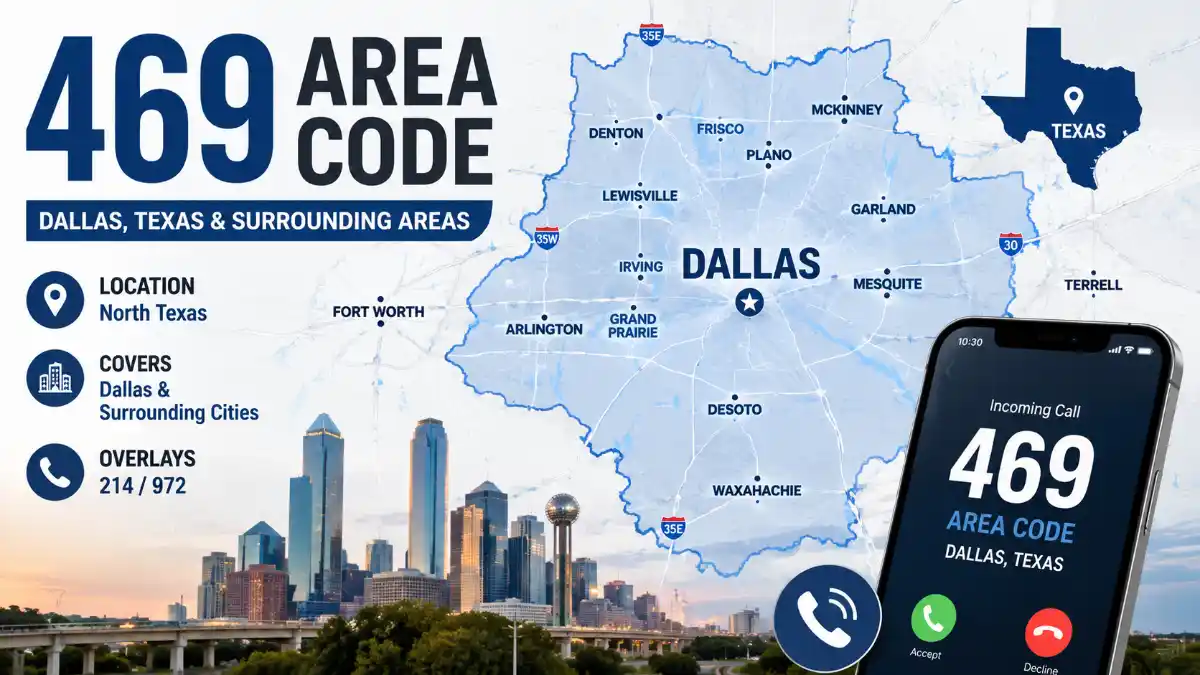
    Area code 469 serves the Dallas-area numbering region in Texas. As a Dallas area code, 469 operates within the 214/469/972/945 overlay, meaning all four codes share the same primary territory rather than dividing it geographically.

    469 Area Code at a Glance

    DetailAnswer
    StateTexas
    Primary regionDallas metropolitan area and parts of eastern Tarrant County
    Area code469
    Overlay codes214, 972, 945
    Time zoneCentral Time (CT)
    IntroducedJuly 1, 1999
    Local dialing10 digits required
    Numbering pool exhaust forecastQ3 2035

    Where Is the 469 Area Code Located?

    The Dallas-area 214/469/972/945 numbering region includes Dallas County and communities in parts of Collin, Denton, Fannin, Hunt, Johnson, Kaufman, and Tarrant counties, per Texas Public Utility Commission documentation. Because numbering blocks and rate centers do not follow political boundaries, city and county associations within the 469 area code location can vary by source, and other numbering references may associate individual 469 prefixes with communities outside this core description.

    Which Cities Are Associated With the 469 Area Code?

    469 prefixes are associated with numerous Dallas-area communities, but individual cities can also have 214, 972, or 945 numbers. Because prefixes are assigned through numbering blocks and rate centers, a city’s presence on a 469 area code cities list doesn’t mean every number in that city uses 469.

    CityCountyAssociation
    DallasDallasMajor 469 market
    PlanoCollin469-associated community
    GarlandDallas469-associated community
    IrvingDallas469-associated community
    McKinneyCollin469-associated community
    FriscoCollin/Denton469-associated community
    CarrolltonDallas/Denton469-associated community
    RichardsonDallas/Collin469-associated community
    LewisvilleDenton469-associated community
    AllenCollin469-associated community
    RockwallRockwall469-associated community
    WaxahachieEllis469-associated community
    EnnisEllis469-associated community

    Read More: 469 Area Code

    Additional communities associated with 469 area code Texas prefixes include Wylie, Murphy, Little Elm, The Colony, Royse City, Terrell, Forney, DeSoto, Duncanville, Cedar Hill, Lancaster, Euless, and Bedford. This table reflects common associations rather than exclusive coverage.

    Is 469 a Dallas or Fort Worth Area Code?

    469 is primarily a Dallas-area code, while Fort Worth and Arlington primarily use 817 and 682. AT&T’s current Texas area-code reference groups Dallas under 214/469/972/945 and Fort Worth/Arlington under the separate 817/682 complex.

    Area CodesMain Region
    214 / 469 / 972 / 945Dallas-area overlay
    817 / 682Fort Worth-area overlay

    The Dallas overlay also extends into parts of Tarrant County, while Fort Worth and Arlington primarily use 817 and 682. Because numbering follows exchanges and rate centers rather than city boundaries, some individual 469 prefixes may appear in databases for communities near the Dallas–Fort Worth boundary.

    What Time Zone Is the 469 Area Code In?

    Area code 469 is in the Central Time Zone. It observes UTC-6 during Central Standard Time and UTC-5 during Central Daylight Time, matching the rest of the Dallas–Fort Worth Metroplex.

    What Does a 469 Caller ID Actually Mean?

    A 469 area code confirms only that a phone number is associated with the Dallas-area numbering region – it does not confirm the caller’s current location. Numbers can be ported between carriers, reassigned to mobile devices, routed through VoIP services, or used by businesses operating outside Texas entirely.

    How Does 469 Compare With 214, 972, and 945?

    469, 214, 972, and 945 are the four area codes in the Dallas-area overlay; the codes do not represent separate geographic zones. Area code 972 was created by splitting territory from 214 in 1996. In 1999, that split line was eliminated, and 469 was introduced as an overlay covering the combined 214/972 territory. Area code 945 joined as the fourth overlay code in 2021, serving the same geographic area as the existing three codes.

    Area CodeIntroducedRole
    2141947Original Dallas-area code
    9721996Created from a 214 split; later converted into an overlay
    4691999Introduced as an overlay covering the combined 214/972 territory
    9452021Added as the fourth overlay code

    Read More: 469 Area Code

    For everyday callers, there is no meaningful geographic difference between 214, 469, 972, and 945. The four codes belong to the same Dallas-area overlay, and the specific code generally reflects when and where the phone number was assigned. Ten-digit dialing is required for every local call because multiple area codes serve the same numbering region.

    Is a 469 Number a Landline or a Cell Phone?

    A 469 area code phone number can be a landline, a mobile number, or a VoIP line. The area code itself does not indicate the type of service behind it.

    Can a 469 Number Be Spoofed?

    Yes, caller ID, D including the area code, de can be manipulated to make a call appear local when it isn’t. A 469 prefix reflects only the numbering block a call was assigned from – it doesn’t authenticate the caller’s identity.

    What to Do If You Get an Unknown 469 Call

    • Don’t assume the caller is actually in Dallas.
    • Never share passwords, banking details, or verification codes over an unsolicited call.
    • Let unexpected calls go to voicemail when the number is unfamiliar.
    • Look up the organization independently if the caller claims to represent a business.
    • Remember that caller ID display can be spoofed regardless of the area code shown.

    Getting a 469 Area Code Number

    A new 469 area code phone number can typically be obtained through a VoIP provider, a traditional carrier, or a virtual number service, subject to current prefix availability. VoIP and virtual number services generally offer the most flexibility for selecting a 469 number regardless of physical location.

    When Will Dallas Need a Fifth Area Code?

    NANPA’s latest published exhaust data projects the 214/469/945/972 numbering pool to reach exhaustion in Q3 2035. This is a forecast based on current assignment trends, not a guaranteed date for a new area code, and it can shift as number demand changes.

    Frequently Asked Questions

    Is 469 a Dallas number?

    Yes. It’s one of four codes in the Dallas-area overlay, alongside 214, 972, and 945, and all four use identical dialing rules within the region.

    Where is the 469 area code, and does it cover Fort Worth?

    The 469 area code is located in the Dallas metropolitan area of Texas. It does not primarily cover Fort Worth; Fort Worth and Arlington use the separate 817/682 complex, while the Dallas overlay also extends into parts of Tarrant County.

    When was the 469 area code created?

    July 1, 1999, when it was introduced as an overlay covering the combined 214/972 numbering territory.

    How can I tell if a 469 call is a scam?

    A 469 area code doesn’t verify a caller’s identity, since caller ID can be spoofed. If an unexpected caller asks for money, passwords, account numbers, or verification codes, hang up and contact the organization through an independently sourced number before responding.

    Can I get a 469 number if I live outside Texas?

    Yes, through VoIP or virtual number providers that assign numbers independent of physical location.

    When is the Dallas numbering pool expected to run out?

    Q3 2035, according to NANPA’s latest published exhaust forecast, though this projection can change as demand shifts.

  • Italy Map: Regions, Cities, and Geography Explained

    Italy Map: Regions, Cities, and Geography Explained

    Italy’s boot-shaped peninsula stretches into the Mediterranean Sea, home to 20 regions, nearly 59 million people, and a mountainous spine that shapes everything from climate to economic activity. This guide walks through Italy’s political, physical, and tourist maps – with region-by-region breakdowns and practical examples for travelers, students, and researchers who need to understand how the country is laid out.

    Italy Map Quick Overview

    FactDetail
    Total area301,340 km² (116,350 sq mi)
    PopulationApproximately 58.9 million
    CapitalRome
    Number of regions20 (5 autonomous)
    Highest pointMont Blanc, 4,810 m
    Longest riverPo River, 652 km
    Bordering countriesFrance, Switzerland, Austria, Slovenia
    Enclave statesSan Marino, Vatican City
    Coastline lengthApproximately 7,600 km
    North-to-south lengthApproximately 1,200 km

    Italy’s population has stabilized in recent years after more than a decade of gradual decline, with immigration now offsetting a falling birth rate.

    Where Is Italy Located?

    Italy sits in Southern Europe, extending as a peninsula into the central Mediterranean Sea, between latitudes 35° and 47° North. It shares land borders with France to the west, Switzerland and Austria to the north, and Slovenia to the east, with San Marino and Vatican City existing as independent enclaves fully surrounded by Italian territory.

    Beyond the mainland, the country includes the islands of Sicily and Sardinia, plus nearly 800 smaller islands scattered along its coasts.

    How to Read an Italy Map: A Beginner’s Guide

    Reading a map of Italy correctly starts with separating three layers: political boundaries, terrain, and orientation. Most confusion comes from mixing these up.

    1. Identify north, center, and south – climate, culture, and cost of living shift noticeably across these zones.
    2. Locate the spine – the Apennine Mountains run down the middle, so major cities sit on the coast or in valley basins, not along the ridge itself.
    3. Check the islands separately – Sicily and Sardinia are often shown in inset boxes, which distorts their real distance from the mainland.
    4. Match color coding to regions, not provinces – political maps color-code the 20 regions, while provinces appear only as thin internal lines.
    5. Use the scale bar – Italy’s elongated shape makes it easy to underestimate distances, such as the roughly 1,400-kilometer road journey between Milan and Palermo.

    Common Mistakes When Reading Italy Maps

    • Assuming Sicily and Sardinia sit close together – they’re separated by about 280 km of open sea.
    • Confusing Naples’ surrounding region, Campania, with the city itself when reading regional statistics.
    • Underestimating north-south travel time, since mountainous terrain slows both road and rail speeds.
    • Treating Trentino-Alto Adige as culturally uniform with the rest of the country, when it has a distinct German-speaking population near the Austrian border.

    Read More: Italy Map

    Italy Political Map: Regions and Administrative Divisions

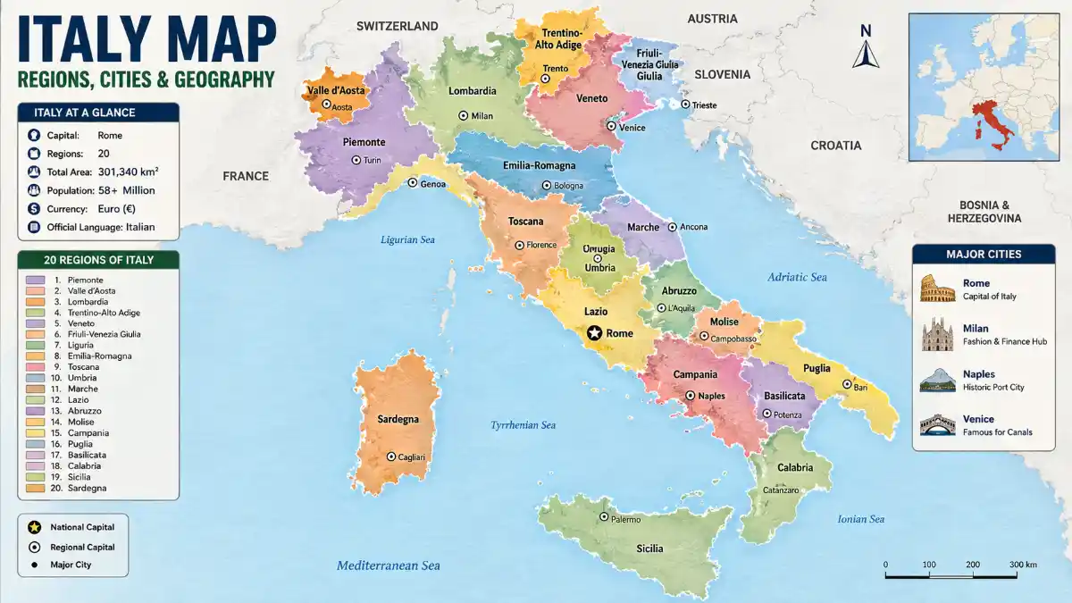
    Italy is divided into 20 administrative regions, five of which hold special autonomous status: Sicily, Sardinia, Friuli-Venezia Giulia, Trentino-Alto Adige, and Valle d’Aosta. These regions carry greater legislative independence, often tied to historical or linguistic factors, and are further split into roughly 107 provinces and metropolitan cities.

    Northern Italy Regions

    • Lombardy (capital: Milan) – the country’s most populous and wealthiest region
    • Piedmont (capital: Turin) – bordering France, known for wine and industry
    • Veneto (capital: Venice) – home to the canal city, Verona, and Lake Garda
    • Emilia-Romagna (capital: Bologna) – a culinary and industrial hub
    • Liguria (capital: Genoa) – the coastal “Italian Riviera,” including the Cinque Terre villages
    • Friuli-Venezia Giulia (capital: Trieste)
    • Trentino-Alto Adige (capital: Trento) – includes the Dolomites
    • Valle d’Aosta (capital: Aosta) – the country’s smallest region, set in the Alps

    Central Italy Regions

    • Lazio (capital: Rome) – the capital region
    • Tuscany (capital: Florence) – celebrated for Renaissance art and rolling countryside
    • Umbria (capital: Perugia) – landlocked, often called the “green heart of Italy”
    • Marche (capital: Ancona)
    • Abruzzo (capital: L’Aquila) – mountainous, bordering the Adriatic

    Southern Italy Regions

    • Campania (capital: Naples) – includes the Amalfi Coast and Pompeii
    • Puglia (capital: Bari) – the “heel” of the boot
    • Calabria (capital: Catanzaro) – the “toe” of the boot
    • Basilicata (capital: Potenza)
    • Molise (capital: Campobasso)
    • Sicily (capital: Palermo) – separated from the mainland by the narrow Strait of Messina; home to Mount Etna, Europe’s most active volcano
    • Sardinia (capital: Cagliari)

    Region Reference Table

    RegionCapital CityPopulation Density
    LombardyMilanHigh
    LazioRomeHigh
    CampaniaNaplesVery high
    SicilyPalermoModerate
    Valle d’AostaAostaLow
    BasilicataPotenzaLow

    Read More: Italy Map

    Why Northern Italy Is Wealthier: A Geographic Explanation

    Northern Italy’s economic strength traces directly to its terrain. The flat, fertile Po Valley enabled early industrialization, while proximity to France, Switzerland, and Austria gave the region easier access to European trade routes than the mountainous, historically isolated south. Milan and Turin grew into manufacturing and finance centers partly because the terrain allowed efficient road and rail networks – an advantage the Apennine-dominated south never had at the same scale.

    The south’s mountainous and volcanic landscape, including areas near Mount Vesuvius and Mount Etna, made large-scale industrial infrastructure harder to build, so its economy leaned more heavily on agriculture and, more recently, tourism. This geographic divide still shows up in income and infrastructure differences between the two zones.

    Northern vs. Central vs. Southern Italy: Map Differences

    FeatureNorthern ItalyCentral ItalySouthern Italy
    EconomyIndustrial, financial hubGovernment, tourism, agricultureAgriculture, growing tourism
    ClimateContinental, colder wintersMediterranean, mildMediterranean, hot summers
    Major citiesMilan, Turin, VeniceRome, FlorenceNaples, Bari, Palermo
    Cost of livingHighestModerate to highGenerally lowest
    TerrainAlps, Po ValleyApennines, coastal hillsApennines, coastal plains, volcanic zones
    Language variationDistinct dialects, German in South TyrolStandard Italian dominantStrong dialects (Neapolitan, Sicilian)

    Best Regions by Purpose: Travel, Study, or Relocation

    Which region suits you depends on your goal – a traveler chasing coastline has different needs than a student seeking an affordable university city or a professional considering relocation.

    • For travel: Tuscany, Campania, and Veneto offer the densest concentration of iconic sights within manageable distances.
    • For study: Emilia-Romagna, home to the University of Bologna, one of the world’s oldest universities, and Lombardy offer strong academic infrastructure.
    • For relocation and cost of living: Puglia and Calabria offer lower living costs than northern cities like Milan, though with fewer job opportunities.
    • For business and finance: Lombardy remains the country’s undisputed economic center.
    • For nature and outdoor activity: Trentino-Alto Adige and Valle d’Aosta, home to the Dolomites and Alps, suit hikers and skiers.

    For first-time visitors, Lazio (Rome) is generally the most practical starting point, given its major international flight connections and easy rail access to Tuscany, Naples, and the Amalfi Coast.

    Map of Italy with Cities: Where the Major Hubs Sit

    Rome, Milan, Naples, and Turin are the four largest cities, each anchoring a distinct region and economic zone.

    CityRegionRole
    RomeLazioPolitical capital, historic center
    MilanLombardyFinance, fashion, design
    NaplesCampaniaSouthern port, near Mount Vesuvius
    TurinPiedmontAutomotive, industry
    PalermoSicilyLargest city on the island
    BolognaEmilia-RomagnaUniversity city, food capital
    FlorenceTuscanyRenaissance art hub
    VeniceVenetoCanal city on a lagoon
    GenoaLiguriaHistoric maritime port
    BariPugliaKey Adriatic port

    Cities cluster densely across the northern Po Valley and along both coastlines, while the mountainous interior – particularly Abruzzo, Molise, and Basilicata – remains sparsely populated.

    Italy Physical Map: Mountains, Rivers, and Terrain

    Nearly 40% of Italy’s territory is mountainous, dominated by two ranges: the Alps in the north and the Apennines running the length of the peninsula.

    The Alps and Apennines

    The Alps form Italy’s northern border, shared with France, Switzerland, and Austria. The country’s highest point, Mont Blanc, rises to 4,810 meters on the France-Italy border. Within this range, the Dolomites in the northeast are famed for dramatic limestone peaks and hold UNESCO World Heritage status.

    South of the Alps lies the Po Valley, Italy’s largest and most fertile plain, stretching from Piedmont through Lombardy and Veneto to the Adriatic near Venice – also the country’s most industrialized lowland.

    The Apennine Mountains stretch roughly 1,200 to 1,350 kilometers down the peninsula’s center, continuing beneath the Strait of Messina into Sicily.

    Major Rivers and Lakes

    The Po River is Italy’s longest at 652 kilometers, flowing from the Alps into the Adriatic Sea. Other key features include:

    • Adige (410 km) – flows through the northeast
    • Tiber (405 km) – flows through Rome
    • Arno (241 km) – flows through Florence and Pisa
    • Lake Garda, Lake Como, and Lake Maggiore – the largest northern lakes near the Alps; Lake Como is known for its lakeside villas and mild microclimate, while Lake Garda is Italy’s largest lake by surface area

    Surrounding Seas

    • Tyrrhenian Sea – west coast, near Rome, Naples, and Sicily
    • Adriatic Sea – east coast, near Venice and Bari
    • Ionian Sea – south, near Calabria and Puglia
    • Ligurian Sea – northwest, near Genoa and the Cinque Terre

    Italy Tourist Map: Key Destinations by Region

    Most visitors concentrate on five regions – Lazio, Tuscany, Veneto, Campania, and Sicily – connected efficiently by Italy’s high-speed rail network.

    • Rome, Florence, Venice – the classic “Golden Triangle”
    • Tuscany and Umbria – countryside and hilltop towns like Siena and Assisi
    • Amalfi Coast and Naples – coastal scenery, Pompeii, Capri
    • Cinque Terre – five clifftop fishing villages linked by coastal trails
    • The Dolomites – alpine scenery and resorts like Cortina d’Ampezzo
    • Sicily – ancient ruins, Mount Etna, Mediterranean beaches
    • Sardinia – secluded beaches and a distinct regional culture

    Example: Reading a Route from Rome to Milan

    On a map, Rome and Milan sit roughly 477 kilometers apart by rail, cutting through Lazio, Tuscany, and Emilia-Romagna before reaching Lombardy. High-speed trains cover this route in about 3 hours, while driving takes closer to 5.5 hours over 570 kilometers, since road routes curve more around the Apennines.

    Example: A Milan–Venice–Florence Loop

    A common map-based itinerary works like this: start in Milan for fashion and finance, take a roughly 2.5-hour train east to Venice for its canals and lagoon, then head south for about 2 hours to Florence for Renaissance art before continuing to Rome. This route works efficiently because all four cities sit on Italy’s main high-speed rail corridor, unlike smaller towns off that line, which require slower regional connections.

    How Geography Shapes Italy’s Transport Network

    Italy’s rail network follows its terrain closely. High-speed lines run along the flatter Po Valley and coastal corridors, while mountainous interior regions like Basilicata and Molise rely more on regional trains and roads. This explains why itineraries built around Rome, Florence, Milan, and Venice feel seamless, while reaching interior towns in Abruzzo or Calabria takes noticeably longer despite shorter map distances.

    Italy’s Size Compared to Other Countries

    Italy is about 24% larger than the United Kingdom but roughly 45% smaller than metropolitan France.

    ComparisonItalyOther CountryDifference
    vs. United Kingdom301,340 km²~243,600 km²Italy is about 1.24 times larger
    vs. Metropolitan France301,340 km²~551,500 km²France is larger by area
    Population~58.9 millionUK: ~69 millionUK has more people despite less land area

    Political vs. Physical vs. Tourist Maps: What’s the Difference?

    Map TypePrimary UseKey Features Shown
    PoliticalAdministrative reference, educationRegional borders, provinces, capital cities
    PhysicalGeography study, terrain planningMountains, rivers, elevation, coastlines
    TouristTrip planningAttractions, transport links, popular routes

    Choosing the right one depends on your goal – a road trip through the Apennines calls for a physical map, while researching the country’s government structure calls for a political layout of Italy’s regions.

    Frequently Asked Questions

    How many regions does Italy have?

    Italy has 20 regions, five of which – Sicily, Sardinia, Friuli-Venezia Giulia, Trentino-Alto Adige, and Valle d’Aosta – hold special autonomous status with greater legislative powers, often due to historical or linguistic distinctiveness.

    What countries border Italy?

    Italy borders France, Switzerland, Austria, and Slovenia, plus the enclave microstates San Marino and Vatican City, which sit entirely within Italian territory.

    Is Italy bigger than the UK?

    Yes. Italy covers about 301,340 km², roughly 24% larger than the United Kingdom’s 243,600 km², despite the UK having a larger population.

    How long is Italy from north to south?

    Italy stretches approximately 1,200 kilometers from north to south, making it one of Europe’s most elongated countries and a key reason travel times vary so much between regions.

    How far is Rome from Milan?

    Rome and Milan are about 477 kilometers apart by rail and roughly 570 kilometers by road, with high-speed trains covering the distance in around 3 hours.

    What is Italy divided into administratively?

    Italy is divided into 20 regions, which are further split into roughly 107 provinces and metropolitan cities, the second-tier administrative units that handle local infrastructure and services.

    What is the highest point in Italy?

    Mont Blanc, at 4,810 meters, sits on the France-Italy border in the Alps. Gran Paradiso, at 4,061 meters, is the highest peak located entirely within Italian territory.

    Which region is best to visit first in Italy?

    Lazio, home to Rome, is typically the best starting point for first-time visitors due to major international flight connections and easy rail access to Tuscany, Naples, and the Amalfi Coast within a few hours.

    Are Sicily and Sardinia part of mainland Italy?

    Both islands are integral Italian territory, though geographically separate from the mainland. Sicily sits just off the “toe” of the peninsula across the Strait of Messina, while Sardinia lies further west, closer to Corsica than to the Italian mainland.

    Is Italy larger or smaller than France?

    Italy is smaller than metropolitan France, which covers about 551,500 km² compared to Italy’s 301,340 km², making France roughly 83% larger by area.

  • What Is A Compass Rose? A Complete Guide To Map Directions

    What Is A Compass Rose? A Complete Guide To Map Directions

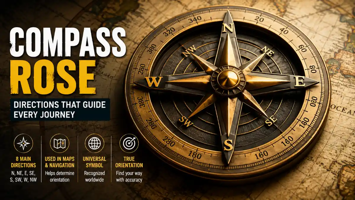
    A compass rose is a symbol printed on maps, charts, and compasses that displays the cardinal and intermediate directions, helping readers understand a map’s orientation and navigate using it. It typically shows north, south, east, and west, along with additional points such as northeast and southwest for more precise direction-finding.

    Almost every direction, distance, and location reference on a map depends on correctly reading this symbol first. This guide walks through the cardinal and intermediate directions, how bearings work, the different types of compass rose symbols, and how to apply them to real map-reading situations.

    Compass Points and Bearings

    DirectionAbbreviationBearingOpposite Direction
    NorthN0°/360°South
    NortheastNE45°Southwest
    EastE90°West
    SoutheastSE135°Northwest
    SouthS180°North
    SouthwestSW225°Northeast
    WestW270°East
    NorthwestNW315°Southeast

    Read More: Compass Rose

    What Does a Compass Rose Show?

    A compass rose shows the directional orientation of a map by displaying the four cardinal directions and, in more detailed versions, the intermediate directions between them. Cartographers include it because a map can be printed at any angle, and without a fixed reference point, there’s no reliable way to know which direction is “up” on the page.

    8-point compass rose: cardinal directions appear every 90°, while intermediate directions fall halfway between them at 45° intervals.

    Most modern maps orient north toward the top, but this is a convention rather than a fixed rule. Some historical maps, trail maps, and specialty charts orient differently, which is exactly why checking the compass rose first – rather than assuming north sits at the top – matters for accurate map reading.

    The Four Cardinal Directions

    The cardinal directions are the four primary points on a compass rose – North (N), East (E), South (S), and West (W) – spaced exactly 90 degrees apart.

    DirectionAbbreviationBearing
    NorthN0°/360°
    EastE90°
    SouthS180°
    WestW270°

    A common classroom mnemonic, “Never Eat Soggy Waffles,” lists the cardinal directions in the clockwise order used in cartography. Compass bearings are conventionally measured clockwise from north, which is why the sequence N → E → S → W matches the direction bearings increase around the circle.

    Intermediate Directions Explained

    Intermediate directions, also called intercardinal or ordinal directions, are the four points located exactly halfway between each pair of cardinal directions: Northeast (NE), Southeast (SE), Southwest (SW), and Northwest (NW). These exist because real-world locations rarely align with a single cardinal direction – a location between north and east is described far more precisely as “northeast” than by either cardinal direction alone.

    Together with the four cardinal points, these eight directions form the 8-point compass rose, a version widely used in introductory geography education and on everyday maps.

    How Bearings Work on a Compass Rose

    A bearing is a direction expressed in degrees, measured clockwise from north, running from 0° at north through 360° back to north. This numeric system lets navigators describe direction precisely instead of relying only on named points.

    • = North
    • 90° = East
    • 180° = South
    • 270° = West
    • 360° = back to North

    A bearing of 135°, for instance, falls exactly at southeast. This degree-based structure is what makes 16-point and 32-point compass rose designs possible – each additional point simply divides the 360-degree circle into smaller, evenly spaced segments.

    How to Read a Compass Rose on a Map

    To read a compass rose, locate north first, then use its position to work out every other direction relative to it.

    1. Locate north first. Look for the letter “N,” an arrow, a star, or a fleur-de-lis symbol.
    2. Check the map’s actual orientation. Confirm which way north points rather than assuming it’s at the top.
    3. Identify the remaining cardinal points. Moving clockwise from north gives east, then south, then west, each 90 degrees apart.
    4. Read intermediate directions if shown. Locate northeast, southeast, southwest, and northwest between the cardinal points.
    5. Use bearings for precision. If the rose includes a 360-degree scale, read the exact bearing (e.g., 135° for southeast) rather than estimating.

    Practical Example

    Suppose a park sits at the center of a map, a school is directly north of the park, and a library is directly east of the school. Tracing north from the park to the school, then east from the school to the library, places the library northeast of the park overall. Working through an example like this, using the compass rose as a fixed reference point, builds the skill faster than memorizing definitions alone.

    Compass Rose vs. a Physical Compass

    A compass rose and a physical compass are related but distinct tools: one is a printed reference, the other is a working instrument.

    FeatureCompass RosePhysical Compass
    FormPrinted symbol on a map or chartPhysical handheld instrument
    FunctionShows the map’s directional orientationPoints toward magnetic north in real time
    MovementStatic – fixed to the mapNeedle moves as you turn
    Typical useReading and interpreting mapsReal-world navigation and orienteering

    Read More: Compass Rose

    Navigators typically use both together, aligning a compass needle with the map’s north indicator to estimate a real-world bearing. When precision matters – such as backcountry hiking or marine navigation over distance – navigators also account for magnetic declination, the offset between magnetic north and true north, when converting between map bearings and compass readings.

    Types of Compass Rose Symbols: 16-Point and 32-Point Roses

    Beyond the basic 8 points, more detailed compass rose symbols subdivide the circle further for navigation contexts that benefit from finer precision, such as sailing, aviation, and historical charting.

    16-Point Compass Rose

    A 16-point rose adds eight secondary intermediate directions, formed by bisecting the angle between each cardinal and intermediate point: North-Northeast (NNE), East-Northeast (ENE), East-Southeast (ESE), South-Southeast (SSE), South-Southwest (SSW), West-Southwest (WSW), West-Northwest (WNW), and North-Northwest (NNW). Each point sits 22.5 degrees from its neighbors.

    16-point compass rose: secondary intermediate directions divide the circle into 22.5° segments for finer precision.

    32-Point Compass Rose

    The 32-point rose divides the circle into segments of 11.25 degrees each, using historical naming conventions such as “north by east.” The compass rose has long served as a core plotting feature on nautical charts, allowing mariners to determine course and bearing directly from the chart. Many nautical charts still include a graduated compass rose today, both as a functional plotting tool and as a link to that navigational tradition.

    Comparison of Compass Rose Types

    TypeNumber of PointsDegrees Between PointsCommon Context
    4-point4 (cardinal only)90°Basic maps, early geography education
    8-point8 (cardinal + intermediate)45°Everyday maps, introductory geography
    16-point1622.5°More detailed maps requiring finer direction
    32-point3211.25°Nautical charts, historical navigation

    True North, Magnetic North, and Grid North

    True north points toward the geographic North Pole, while magnetic north is the direction a compass needle actually follows, a direction that shifts gradually over time as Earth’s magnetic field changes. Charts and topographic maps sometimes display a third reference as well.

    • True north: the fixed direction toward the geographic North Pole, following the Earth’s lines of longitude.
    • Magnetic north: the direction a compass needle points, which drifts over time and differs by location.
    • Grid north: the direction of the vertical grid lines on a map’s coordinate system, such as UTM. Grid north, true north, and magnetic north can each differ slightly depending on location and the map’s projection, an offset called grid convergence.

    On charts showing true and magnetic north together, two concentric circles are common: the outer ring marks true north, fixed to the geographic pole, while the inner ring marks magnetic north. The angular gap between them is called magnetic declination, and its size varies by location on Earth. This distinction matters most for sailors, pilots, and hikers navigating with a physical compass and chart, since applying the wrong reference over long distances can cause a meaningful course error.

    Why Compass Roses Still Matter

    Even with GPS and digital navigation apps handling most everyday direction-finding, compass roses remain a foundational teaching tool in geography education and continue to appear on nautical charts, historical maps, and orienteering materials. Many digital mapping interfaces use a simplified orientation indicator – usually a small arrow or “N” marker – that serves the same basic function without the decorative design.

    For students, mastering the compass rose builds the groundwork for related map skills, including reading latitude and longitude, understanding map scale, and interpreting topographic contour lines.

    Frequently Asked Questions

    What is the difference between cardinal and intermediate directions?

    The cardinal directions (N, E, S, W) are 90 degrees apart and form the compass rose’s four main points. Intermediate directions (NE, SE, SW, NW) fall exactly between them, at 45 degrees from each neighboring cardinal point, allowing for more precise direction descriptions on maps.

    How many points does a compass rose have?

    Compass roses commonly come in 4-point, 8-point, 16-point, and 32-point versions, with each step dividing the circle into smaller, evenly spaced segments: 90°, 45°, 22.5°, and 11.25°, respectively. The 8-point version is the one most learners encounter first.

    Why is north often marked with a special symbol?

    North is often emphasized with a star, arrow, or decorative fleur-de-lis so readers can identify it quickly. This visual emphasis remains common in educational and decorative compass rose designs, even though it isn’t functionally required for the symbol to work.

    Does north always point to the top of a map?

    Not always. Most modern maps place north at the top by convention, but this isn’t universal – some historical maps, trail maps, and specialty charts orient differently. Checking the compass rose or north arrow directly, rather than assuming orientation, avoids navigation errors on unconventional maps.

    What is magnetic declination and why does it matter?

    Magnetic declination is the angular difference between true north and magnetic north, and it varies by location and shifts gradually over time. It matters most for anyone navigating with a physical compass and a paper map, since ignoring declination can cause a meaningful directional error over longer distances.

    What is grid north, and how is it different from true and magnetic north?

    Grid north is the direction of the vertical grid lines on a map’s coordinate system, such as UTM, rather than the geographic pole or a compass needle. Because flat maps distort the curved Earth, grid north can differ slightly from true north – an offset known as grid convergence – and both can differ from magnetic north. On most everyday maps, this difference is small enough to ignore, but it becomes relevant in precise land navigation and surveying.

    How do you draw a simple compass rose?

    Start with a vertical and horizontal line crossing at a center point to mark north, south, east, and west, labeling north at the top and moving clockwise for the rest. For an 8-point version, add a smaller X shape rotated 45 degrees between the main lines to mark northeast, southeast, southwest, and northwest.

    Are compass roses still used on digital maps and GPS apps?

    Digital maps and GPS apps rarely include a full decorative compass rose, but most display a simplified directional indicator – usually a small arrow or “N” marker – serving the same core function. Full 16-point or 32-point roses are now mostly reserved for printed nautical charts, historical maps, and educational materials.

    What’s a quick way to practice reading a compass rose?

    Try a simple exercise: if a school is north of a park, and a library is east of the school, the library sits northeast of the park overall. Practicing a few examples like this on an actual map – tracing directions between two or three landmarks – builds the skill faster than memorizing definitions alone.

    Why do nautical charts sometimes show two compass rings instead of one?

    Charts with two concentric circles are typically distinguishing true north from magnetic north. The outer ring shows true north, fixed relative to the geographic pole, while the inner ring shows magnetic north, which shifts over time and location. This dual-ring design helps navigators convert accurately between map bearings and compass readings.